Calderer Cove
The cove of the brave
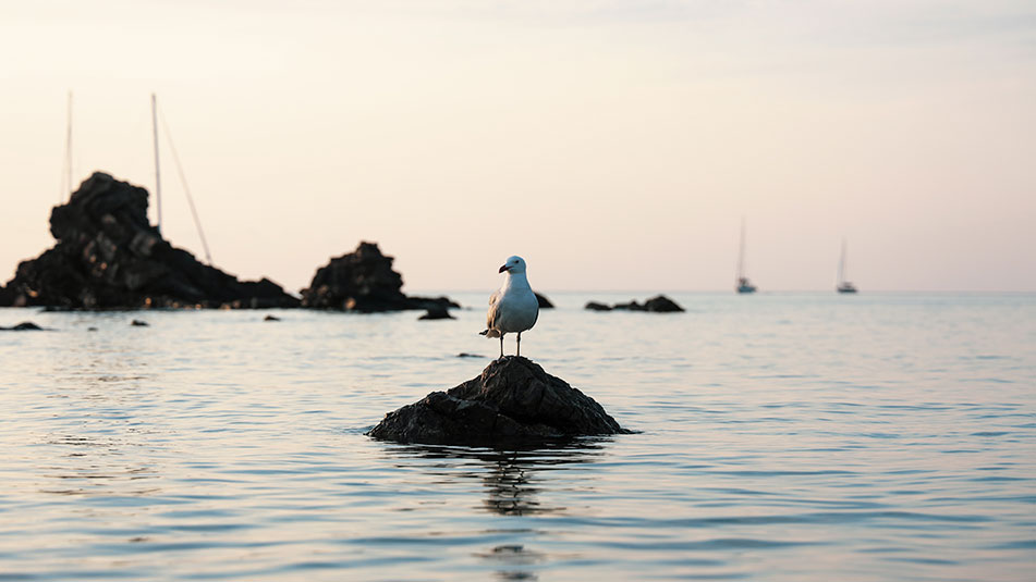
We are not going to lie to you, the way to Cala Calderer is not easy. This small cove, with white sand and shallow bottoms, is located in the middle of nowhere, where solitude and silence reign.
The tramontana does not forgive, and whips its coasts shaping the landscape that surrounds it. Beautiful? No doubt about it. But also rough and inhospitable. Its rocky character is interrupted by the unruly Torrent de Sant Jordi, which intermingles with the hidden dunes behind the beach where small patches of posidonia still hide.
It goes without saying that the services in the area are non-existent (as we know that, just by reading the presentation, you will have deduced it yourselves), but it is necessary to say that, if we want to reach it, a journey of more than 3 km on foot along very irregular paths awaits us, where the traces of human life are scarce (if not practically non-existent).

Name: Cala Calderer
Location: North Zone III (40°3.475’N 4°0.864’E)
Distance from Mahón: 26’3 MN / 39 km
Time from Mahón: 1h 45 min by boat (average speed: 15 knots) / 42 min by car
Type of beach: Sand
Anchoring with boat: Sand and rock. Open to the NW.
Posidonia: Yes
Dangerous access by boat: Medium. Low to the SW.
Nearest boat gas station: 9’5 MN, Port de Fornells
SERVICES

NO SERVICES

WALK 3.3 Km

FONDEADERO

NUDIST
Services near Cala Calderer
NO NEARBY SERVICES*.
*We consider them “close” if they are within a radius of 250-300 m approx.
Cala Calderer in Menorca, how to get there?
If you want to reach it by land, you will have to walk. In other coves, there is the possibility of doing the Camí de Cavalls on foot, by bicycle or even on horseback. This is not the best path to choose either of these options. The unevenness of the terrain already makes the road relatively rough, so let’s not complicate it even more.
Our options to reach it through the Camí de Cavalls are to walk the sixth stage of the path from Els Alocs to Binimel-là, but we can choose to walk east (starting from Els Alocs), or west (starting in Binimel-là).
In the first case, to approach by road, we must take the Me-1 from Mahón to Camí de Tramuntana and follow the signs that lead to Camí dels Alocs, where we will continue until we reach the parking lot located near the beach.
From Els Alocs we will have to travel 3’3 km along this route, to reach Cala Calderer.
On the other hand, if we decide to start our journey in Binimel-là, we must leave Mahón towards Fornells on the Me-7. Then, take the detour to Me-15 and take the third exit at the traffic circle on the road.
From here, we must follow the signs indicating the way to the beach (for about 8 km) and we will arrive at a parking lot where we can park to continue on foot. From here, we will have ahead of us a 4.5 km crossing that, although longer than the previous one, is also in better condition (except for the steep slopes that we will have to overcome along the way).
What to see near Cala Calderer?
Walking, walking and walking…
If our plan is to include more than just walking and swimming, Cala Calderer is not your beach. There is not much to do here except enjoy its solitude and the silence that its secluded location offers.
If you want to know more areas, the Camí de Cavalls will allow you to visit nearby places and, although it is true that perhaps Cala Calderer is not your destination, if you are doing the stage that runs close to it, perhaps it is worth a detour, make a stop along the way and discover the landscape that this remote place can offer.
How to get to Cala Calderer by boat?
To reach Cala Calderer, we will have to leave with our boat from the port of Mahón in SE direction leaving the dock to starboard. We will continue through the port until we reach the open sea (up to Punta de Sant Carles).
At this point, we will leave the San Carlos lighthouse to starboard, and continue to port along the coast (heading NE) where we will pass La Mola and Punta de S’Espero, to continue in a NW direction (always sailing with the coast to port).
We will pass Cap Negre, Punta de Sa Galera and, finally, Punta de sa Cudia. On the port side we will see an inlet that leads to Es Grau and in front we will have Illa d’en Colom. We will have to overcome it leaving it on the port side and continue in a NW direction until we pass the Cap de Mossen Vives and the Escull den Tortuga. From the bow we will see the Cap de Favàritx and its unmistakable lighthouse.
Skirting the Favàritx point, we will advance in a NW direction until we see the Addaia islands. We will pass them on the port side and continue until we reach Punta Pantinat.
We will go around it and sail in a NW direction (passing Punta de na Guillemassa and Punta des Morter) until we reach Cap de Cavallería. We will border it passing between Illa d’els Porros (which will be on the starboard side) and Illot des Pas (which will be on the port side).
Once past the channel between the two, we will descend in a SW direction leaving Illa Bledes, Illa des Coloms and Es Piló on our port side. Once we have passed the latter, we will begin to position ourselves in a S direction because, in the inlet that is past Punta Cala Calde, we will find Cala Calderer.
Do you want to go to Cala Calderer by boat?


